Introduction
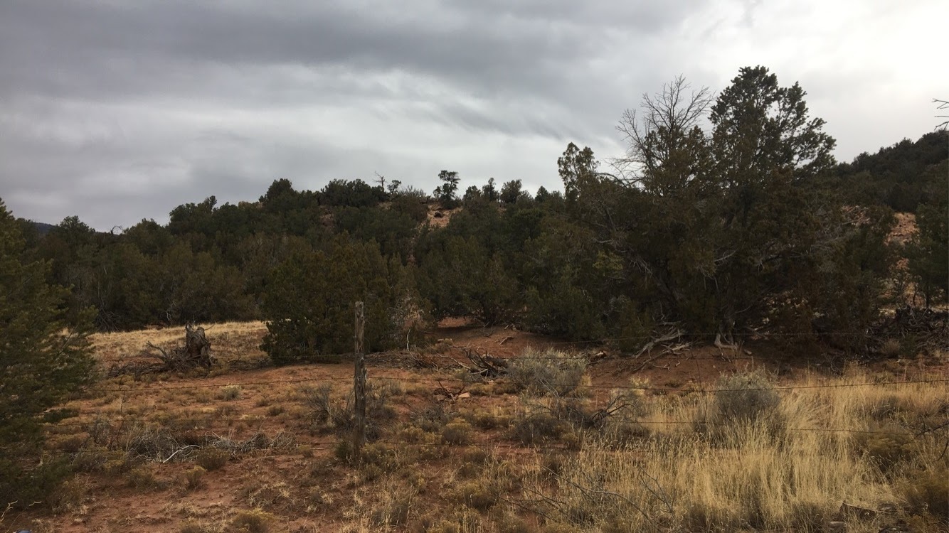
In the Middle Rio Grande region of what is today New Mexico, there are two neighboring mountain ranges east of the Rio Grande: The Sandias and the Manzanos. The mountains, and the settlements beyond them, marked the eastern frontier of the Ancestral puebloan world. Only disparate settlements on the Pecos were further. The eastern face of these mountains, while removed from the vital water of the Rio Grande, nonetheless have access to water through springs and snow-melt creeks. This area is rich with game and trade goods, chiefly salt from Lake Estancia, a nearby Pluvial lake. These settlements were in a very unique position. These pueblos were often positioned in or near canyons which connect one side of the mountains to the other, meaning it was possible to access both the Rio Grande valley and the Llano Estacado with minimal geographic barriers. This predisposed the pueblos of the region to a level of multiculturalism uncommon for the time. Despite the seemingly ideal geographic placement, these pueblos which were at once the heart and the periphery of Puebloan–and later Spanish–civilization were deserted. Though resettlement has been attempted several times, over hundreds of years, the demographics of this area never truly recovered, and this part of New Mexico, especially south of I-40, remains among the least populated areas of the whole state. This begs the question: Why was this? Why were these well connected settlements, located near valuable trade goods, abandoned? Drawing from previous conclusions made about past settlements by the ancestors of these people, and in using those same methods, it can be strongly concluded that the collapse of this place came from two primary sources: Climatic shifts, and conflict. This paper will examine one notable site in-depth as a case study for collapse: Tijeras Pueblo. Looking at historic records, archaeological findings, and historic climatic data, the collapses of the settlements of the Eastern Frontier can be broken down into two large abandonment events. The first occurred ~1370 AD, the second ~1425 AD.
Case Study: Tijeras Pueblo
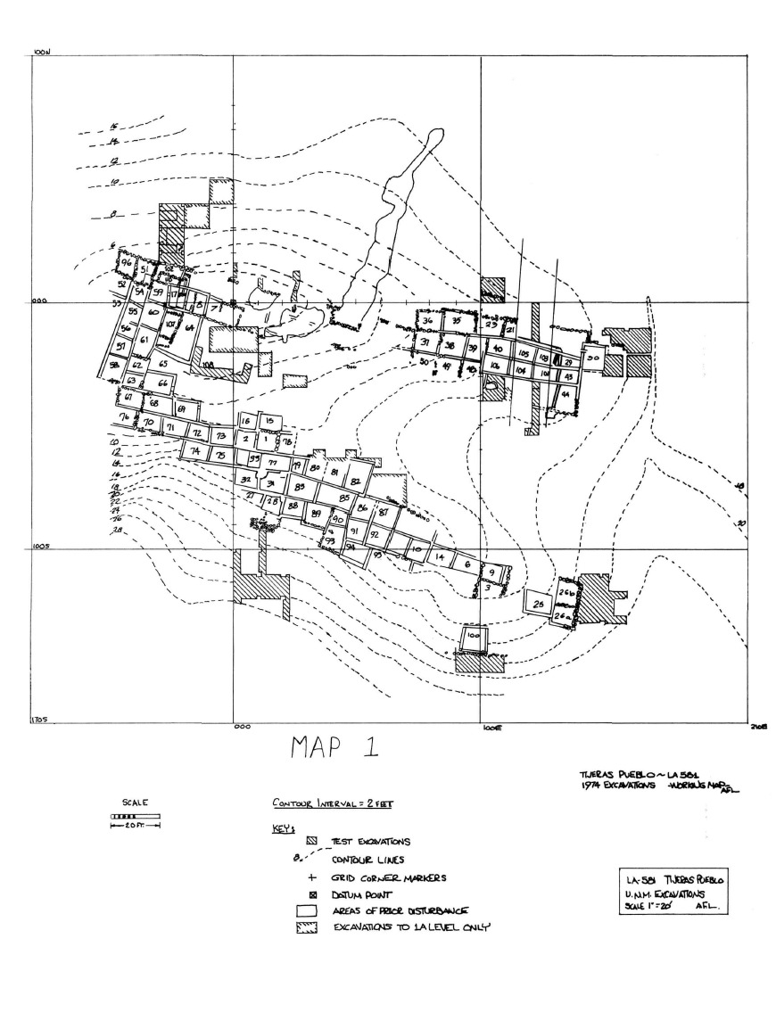
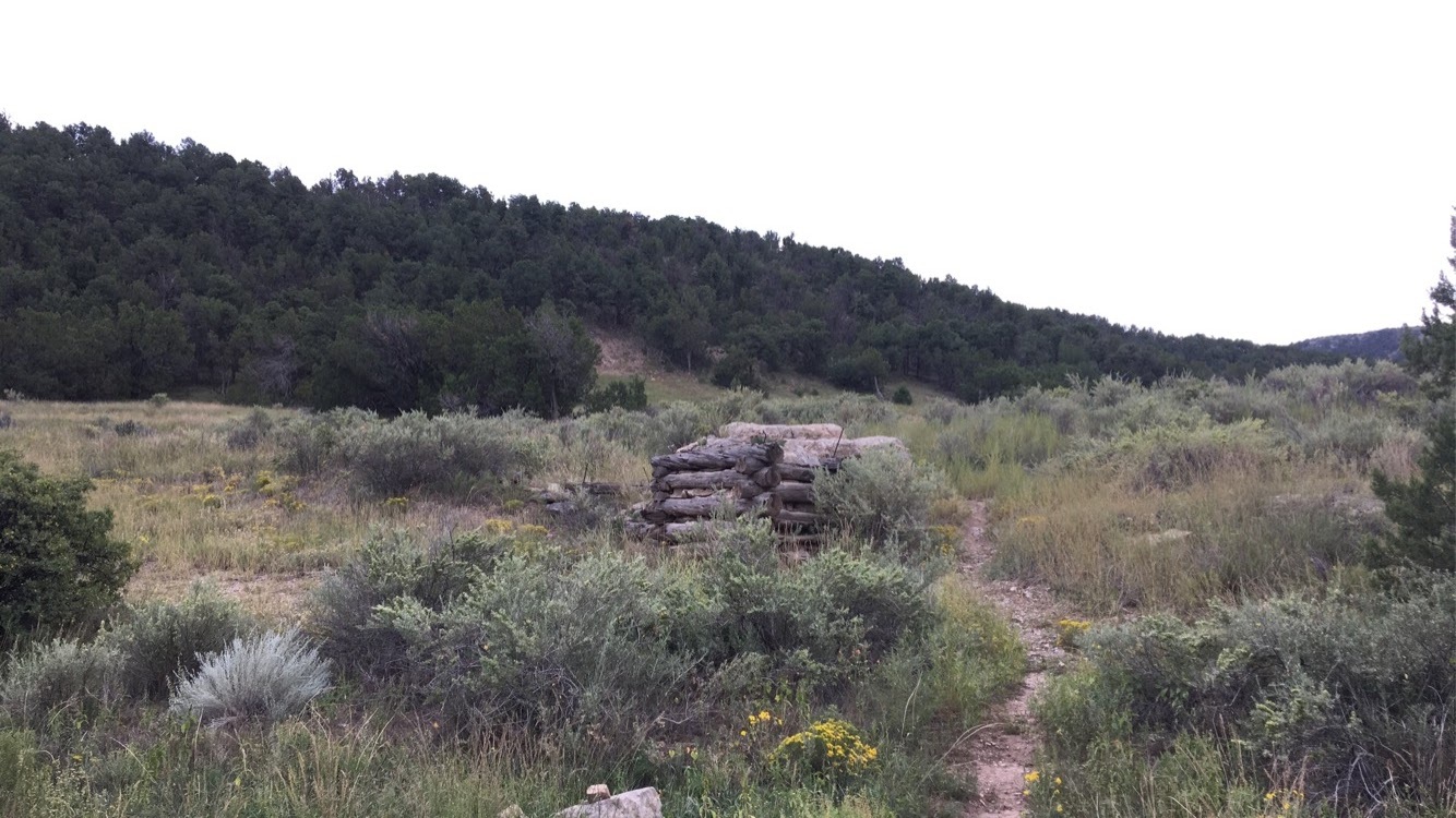
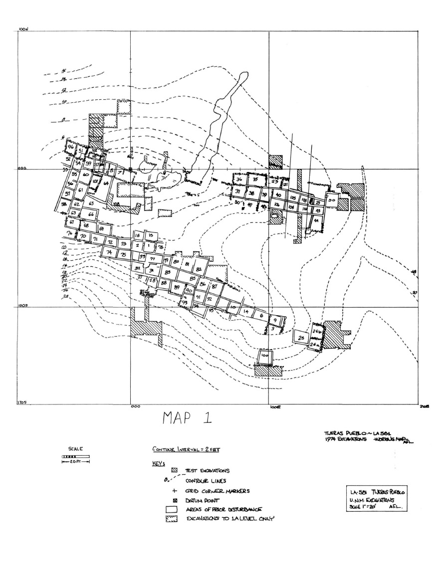
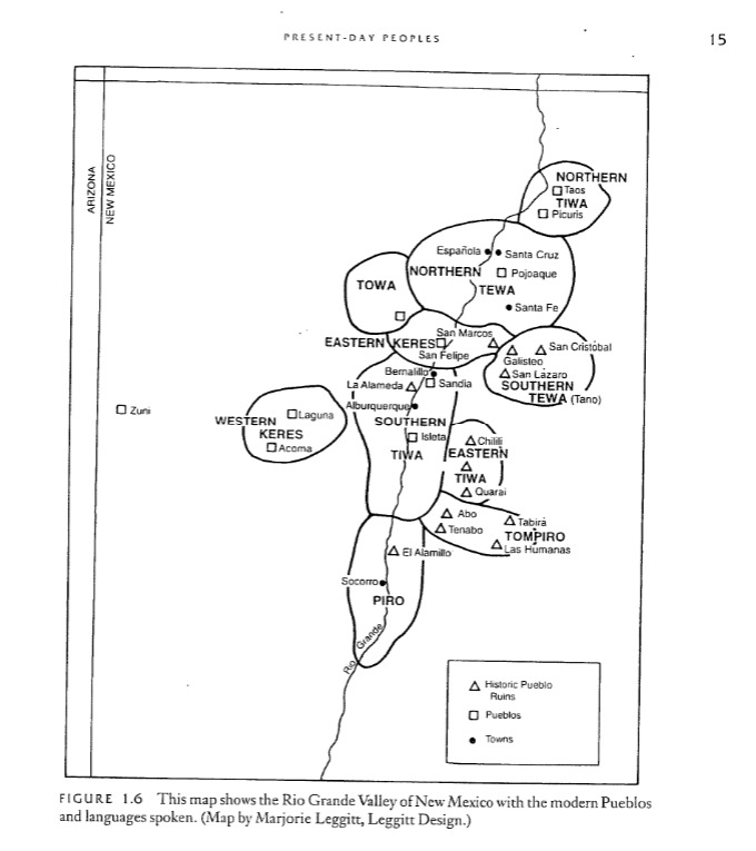
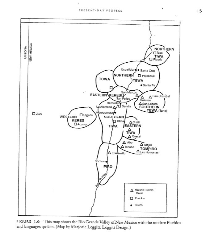
Tijeras Pueblo (35.0751, -106.383)(LA-581) is a Pueblo III/Pueblo IV settlement outside of modern Tijeras, New Mexico. Several excavations of this site occurred between 1948-1973 , the conclusions of which are as follows: This site’s construction began ~1300 AD, and was inhabited until ~1425 AD. There was a brief period of abandonment from ~1370-1390 AD. This site was most likely inhabited initially by Tiwa speakers (fig. 2) (F.o.T.P., 2020) (Cordell, 1984). Tijeras pueblo contained ~200-250 rooms scattered across one main structure and several smaller auxiliaries (Judge & Cordell, 1975: 43). The site previously contained pithouses, though the more robust settlement was constructed until the aforementioned dates. The site is primarily adobe construction, though there is occasional masonry in some foundations, kivas, and other such crucial spaces. Similar to other pueblo villages both contemporary and later, the largest room blocks ring a central plaza (fig. 1).
Turkeys
The Tiwa Indians of Tijeras Pueblo lived very similarly to other Pueblo communities of the time, but were distinct in their distinctly high amounts of hunting and foraging. While standard corn crops were grown at the site, the abundance of game and the lower quality soil made hunting and foraging a much more reliable food source. This reliance on found rather than grown food is reflected in the turkey remains found at the pueblo. Tijeras Pueblo, like the other pueblos, kept domestic turkeys for use as foodstuffs and for their feathers, which were woven into blankets (Conrad, 2021, p. 625) (King, 2021). What makes the turkeys of Tijeras Pueblo distinct, however, is seen in their diet. Analysis of the remains of turkeys found at the pueblo site shows al. 2016, a distinctly large percentage of turkey diets was foraged, or naturally occurring fauna versus the standard domination of cultivated corn as is seen at other sites (Jones et al., 2016, p. 581).
Salt Trade
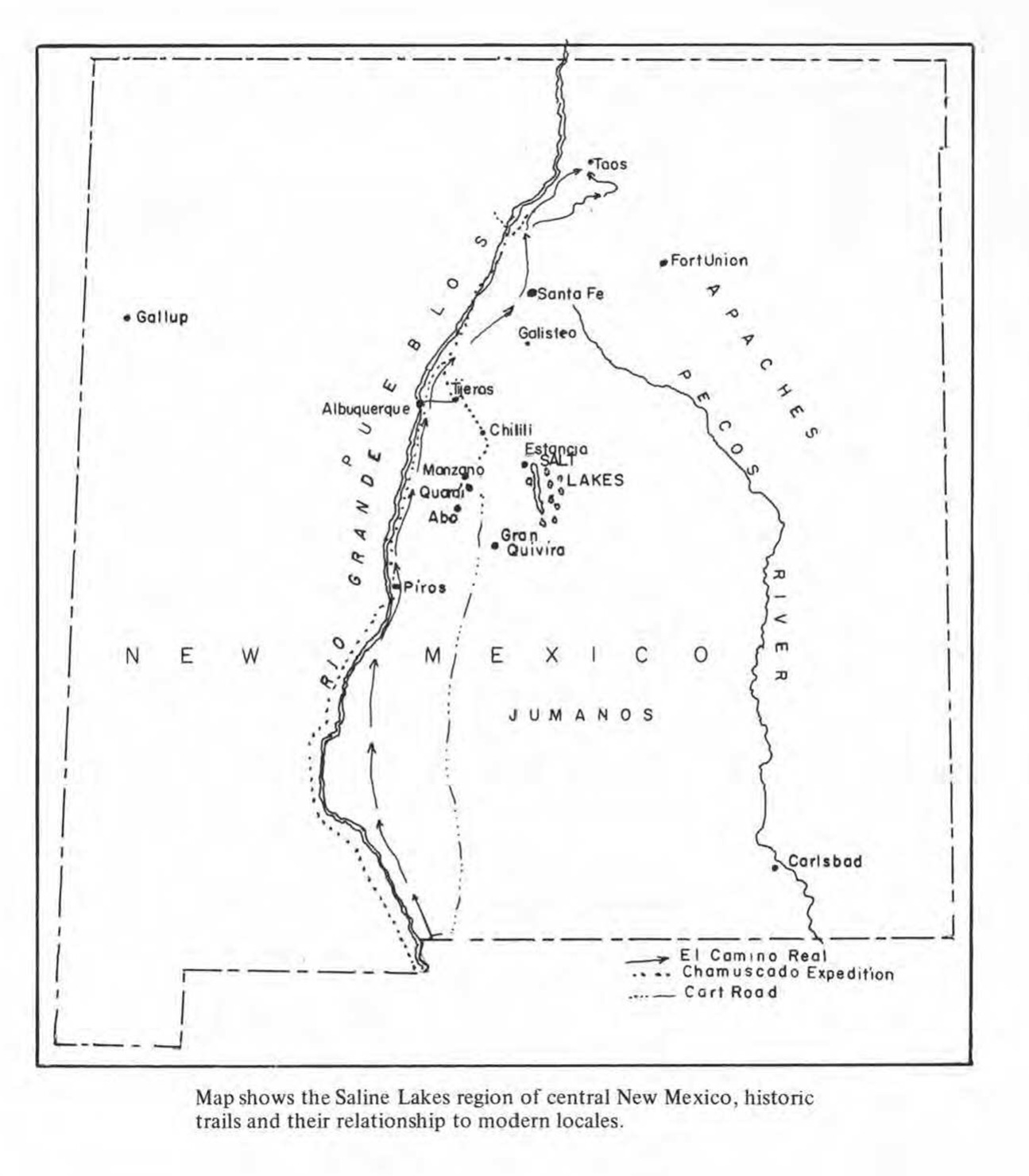
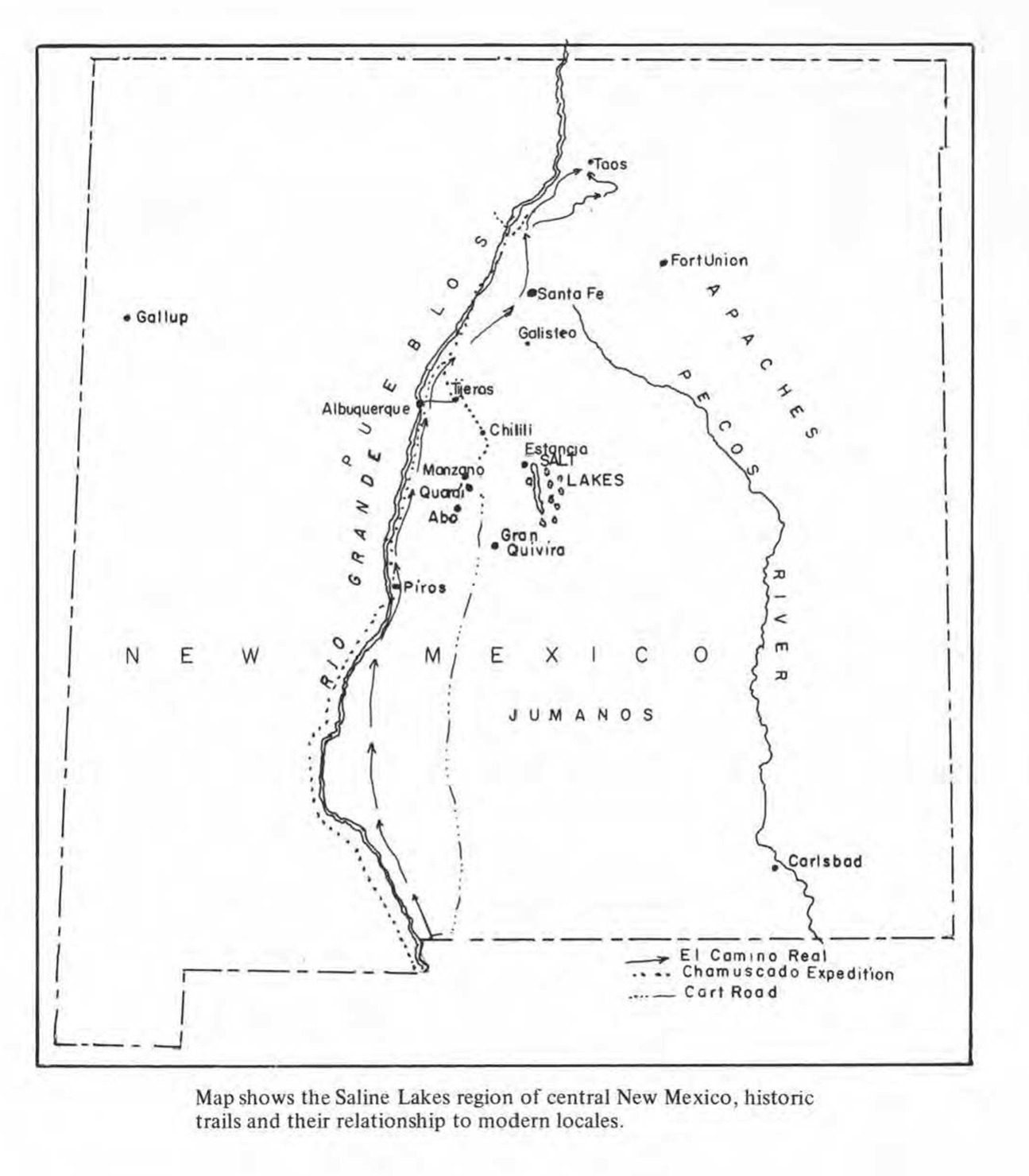
As discussed in the introduction, the geographic situation of Tijeras Pueblo predisposed it to trade and contact with many disparate people groups. Tijeras Canyon, Glorieta Pass and Abo Pass were crucial trade routes passing through the mountains, connecting the Rio Grande Valley to the Llano Estacado (fig. 3). Among the most vital of these goods traded through the Tijeras Canyon was salt, brought from Lake Estancia (Kraemer, 1976, p. 30). While salt itself is not especially rare in New Mexico, the salt of the Estancia Salt Flats is valuable due to its accessibility and edibility (Kraemer, 1976, p. 23). Instead of requiring mining, the salt can simply be picked up from the surface of the dry lakebed.
Dendrochronology
Interestingly, the field report (Judge & Cordell, 1975), is at once a record of previously conducted excavations, as well as the newfound results of the excavations of the 1970’s to that point. This is worthy of note, as much of the evidence supporting the previously mentioned break in habitation from ~1370 - ~1390 AD is supported not only by dendrochronology, but ceramic types as well. Dendrochronology of Tijeras Pueblo was largely conducted during early excavations of the site, especially the 1948 field session. The data collected of the site’s many wooden beams demonstrates clusters of cut-dates aligning with the aforementioned rehabilitation of the ~1390 AD rehabilitation of the site. Infact, 43% of the tree-ring samples taken have a cut date between 1387 and 1393 AD (Judge & Cordell, 1975: 40). The oldest cut dates taken–bar the previous pithouses which date long before Tijeras Pueblo proper–are from 1294 AD (Judge & Cordell, 1975: 40).
Ceramics
.png)
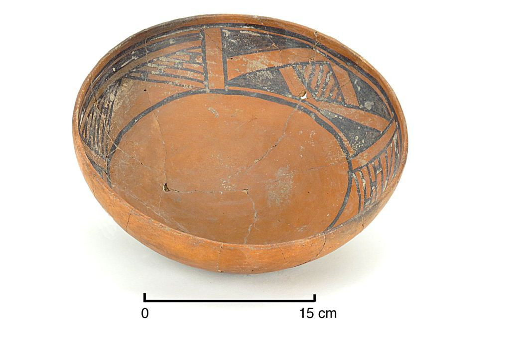
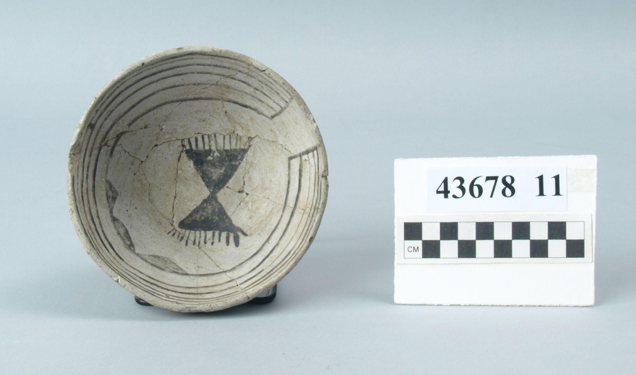
Several pottery styles are found at the ruins of Tijeras. Primarily Agua Fria Glaze-on-Red, but Chupadero Black-on-white, Santa Fe Black-on-White, and Los Padillas Glaze Polychrome were all produced locally at the site as well (Habicht-Mauche, 2022: 761) (Judge & Cordell, 1975: APPENDIX B). Chupadero Black-on-White is surprisingly abundant, being the most frequent Black-on-White ceramic type recovered (Habicht-Mauche, 2022: 761). Interestingly, despite the abundance of Chupadero Black-on-White, it is generally understood to be a tradeware, rather than a locally produced pottery type (Habicht-Mauche, 2022: 761) (Judge & Cordell, 1975: APPENDIX B). Beyond the previously discussed evidence of northern contact via Santa Fe Black-on-white, there were several examples of tradeware found at the site, many of the types coming from south of the pueblo; chiefly Socorro Black-on-white and Los Lunas Smudge (Judge & Cordell, 1975: APPENDIX B). Also worthy of note, the ceramics found at Tijeras Pueblo demonstrate tradelinks westward as well. The archaeological record supports glazed ceramic technology originating in the western Puebloan world in ~1275 AD, and moving east shortly after. Glazed ceramics being found at Tijeras, most notably Agua Fria Glaze-on-Red, therefore demonstrates an exchange of physical goods–or at least technological know-how– from west to east ( Habicht-Mauche, et al. 2021: 757). Fascinatingly, the date ranges on these ceramic types align neatly between the bookends of site habitation, as well as the gap in habitation. For instance, after the break in habitation, Galisteo Black-on-White only occurs as a tradeware, despite being produced locally before (Judge & Cordell, 1975: APPENDIX B). In like manner, Los Lunas Smudged disappears from this site’s archaeological record ~1370 AD, white Abiquiu Black-on-Gray begins appearing ~1375 AD (Judge & Cordell, 1975: APPENDIX B). Several pottery types span the entire duration of habitation, including Cieneguilla Glaze-on-Yellow and the aforementioned Los Padillas Polychrome and Agua Fria Glaze-on-Red (Judge & Cordell, 1975: APPENDIX B). The shifting frequencies, especially around the site’s bookend dates, and the 20-year gap, strongly suggests migration or at least fluctuations in trade frequency–perhaps the severance of certain trade connections–as a result of some external factor which occurred around these dates.
.jpg)
Climatic Data
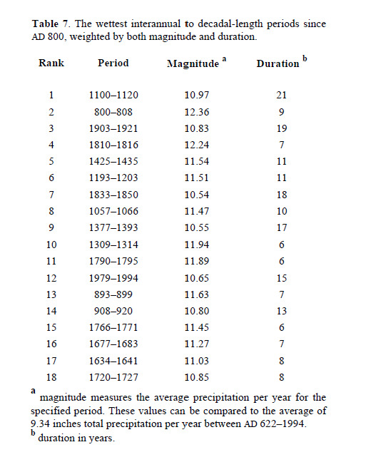
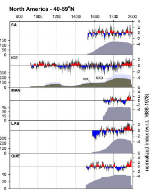
The Southwestern United States has always had a dynamic climate. Though there is never an abundance of water, there are wetter times, and there are certainly drier times. Naturally, heat has fluctuated over time as well. Some periods are warmer, some cooler.This has been a fact of life for the entire history–and prehistory–of the Southwest. Dendrochronology analysis of Southwestern archaeology sites as well as analysis of polar ice cores have given researchers a fairly robust understanding of the climatic conditions of the Southwestern prehistoric–and historic. Interesting to note, is the alignment of climatic cycles with the occupation and abandonment times of Tijeras Pueblo as supported through dendrochronological and ceramic analysis.
_table_listing_10_most_intense_wet_periods_as_determined_from_dendrochronology._notice.png)
_expected_warm_(red)_and_cool_(blue)_periods_as_a_result_of_sampled_climate_data._not.png)
Analysis
What makes this data curious, is the typical pattern of abandonment in the Southwestern United States is one which follows droughts, rather than wet periods. These findings contradict the common narrative of the pueblo’s collapse, which often cites drought as the reason for abandonment (F.o.T.P., 2020). Furthermore, this pattern of drought-based abandonment runs contrary to the settlement timeline of Tijeras Pueblo, which sees lapses in settlement following wet periods rather than droughts. There are several potential explanations for this, but there are two which stand out as more likely and compelling than the others.
First, Tijeras Pueblo was inhabited seasonally–or cyclically (every few years), and the inhabitants of the Pueblo moved up to the mountains during times of drought, and descended during wet periods. The established trade connections of the time–as through ceramics–as well as extant Pueblo Indian groups claiming direct descendancy to those who lived in Tijeras Pueblo, notably Isleta Pueblo (F.o.T.P., 2020), which is along the Rio Grande and geographically adjacent to Tijeras Canyon, may support this hypothesis. When the river is dry due to drought, move up to the springs and snowmelt creeks of the mountains. When the river is full, move down into the valley to farm.
.png)
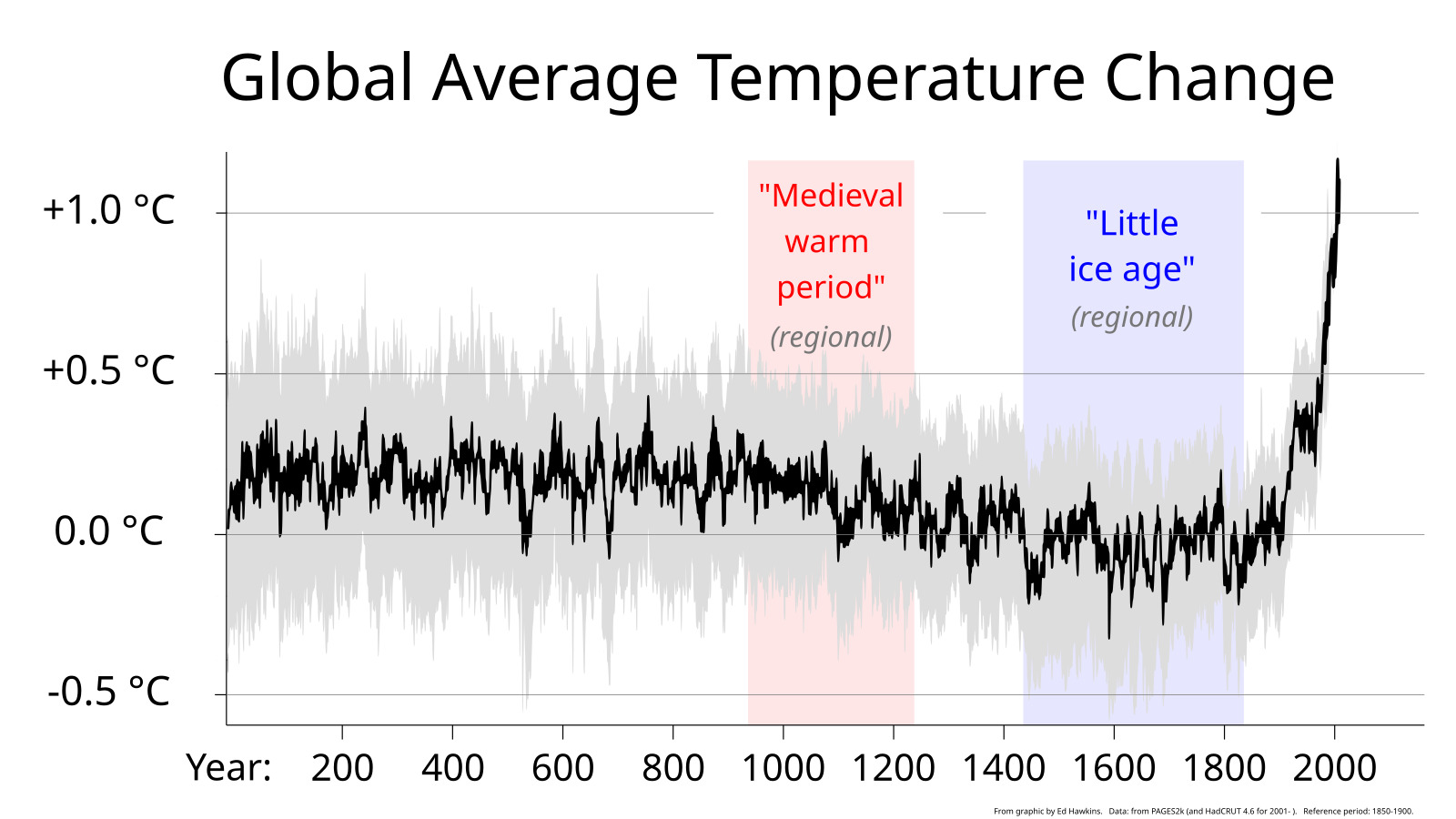
Another alternative is for the Tiwa Indians–rather than moving towards water–move away from snow. Wet periods are good for farming in the summer, but means lots of snow in the winter. The alpine environment of Tijeras Pueblo makes this site vulnerable to snow, especially due to the Pueblo’s location in a narrow valley. An unusually wet winter could result in the residents of the pueblo getting snowed in and unable to leave their homes. Tijeras Pueblo is ~7.5 miles from the edge of Albuquerque city limits, ~20 from the banks of the Rio Grande (Google Maps, 2024), with the Sandia and Manzano Mountains in between the pueblo and the River Valley. Heavy snow could prevent regular trade across these distances–let alone simply walking away from the pueblo or leaving their homes. This latter line of thinking is further supported by the climatic data, as at the time of the final collapse of Tijeras, ~1425 AD, the Southwest was both colder and wetter than normal. In fact, this shift in temperature marked the start of the so-called “Little Ice Age” (fig. 5) globally, which likewise aligns with a wet period in the Southwest (fig. 3).
.jpg)
Conclusion
Tijeras Pueblo, despite its central geographic location and access to natural resources, was abandoned little more than a century after its first constructions were completed. The harness of the climate seems to be the culprit. The archaeological evidence of these interconnected people shows that periods of increased wetness drove people away from the canyon they called home, perhaps a result of the increased precipitation and decreased temperatures, rendering their alpine home too snow-coated for continual habitation. The pressures incentivising the people to stay were overwhelmed by the pressures pushing them to leave. The Tiwa Indians of Tijeras Pueblo, like the citizens of other eastern frontier pueblos, most likely moved into the Rio Grande Valley. At least some did. To date, Isleta Pueblo and other Tiwa-speaking pueblos trace their lineage to these buried walls. Though the population of this village remained relatively small throughout its history, it was nonetheless pivotal to the environment it inhabited. These aforementioned environmental factors rocked the Pueblo world to its core, and set the status quo for the pueblo world until Christian strangers marched their way north from Mexico. These strangers would likewise settle the eastern slopes, but would likewise find it inhospitable after a time. Instead of the environment, it was the people. The Spanish settlements along this eastern face, called the Salinas Missions due to their proximity to the aforementioned Lake Estancia, would be abandoned after the Pueblo revolt. The Tiwa, Piro, and Tompiro people of the area had endured enough hardship at the hands of the Spanish long enough. A long gap followed. The most recent–and the longest enduring–people to call this hostile fringe home were the Mexican families that accepted land grants in the area. These people, and the Americans who followed, now call this place home. All of this to say, the center of New Mexico–the eastern edge of the puebloan world–is no stranger to ebbs and flows, ups and downs. People come and go, Tijeras Pueblo exemplifies this: Two abandonments over its short history. When people leave from the eastern face of these mountains, it is often in harsh, violent ways. From the hostile climate, to Comanche raids, to bloody rebellion. The Tiwa Indians of Tijeras Pueblo perhaps got off easy–having to only battle God instead of God and their neighbors.